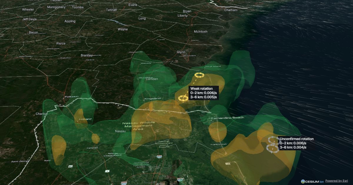
3D Weather Map shows live US weather radar in three dimensions. Instead of a flat radar picture you see each thunderstorm as a 3D shape: how tall it grows, where its heaviest rain and hail cores sit, and how it changes from scan to scan. You can fly into any storm, follow it as it moves, and play back the last 24 hours.
Hurricanes and tropical storms each get their own page with the NHC track, advisory timeline and a satellite and radar loop: all storms.
Privacy · Terms · Data: NOAA MRMS, NEXRAD Level II, GOES, National Weather Service, NHC · Place names: US Census Bureau, GeoNames (CC BY 4.0) · Maps: Esri, Google, OpenStreetMap · 3D engine: CesiumJS
Thanks for taking a look! Right now it's open to a small group of testers while I finish it. More access is coming, with the public launch expected in spring 2027, in time for storm season.
Your 7 days of beta access have ended — thanks for trying it! You're still on the list, and we'll email you when more spots open.
Already have an account? Use the same button to sign in. No password. Your account email joins our update list (launch news, new beta spots); unsubscribe anytime. By signing in you agree to the Terms; see Privacy.
An honest note: this is a hobby project by one person who isn't a meteorologist. It turns NOAA's public radar data — the national MRMS mosaic plus high-detail NEXRAD Level II from individual radar sites — into 3D. It isn't an official warning source, so always follow your local National Weather Service office. Privacy · Terms
Clips are for signed-in beta users. Sign in (free during the beta) to record the replay as an MP4 or GIF with a 3dweathermap.com watermark.
Records the replay ending at the newest frame, from the view you have now (zoom in on a storm first). Keep this tab in front while it records.