Storms › 2026
Tropical Storm Trudy (2026)
Opens the 3D map on Trudy and replays the last 24 hours — satellite cloud tops, NHC track and wind radii — in about 18 seconds.
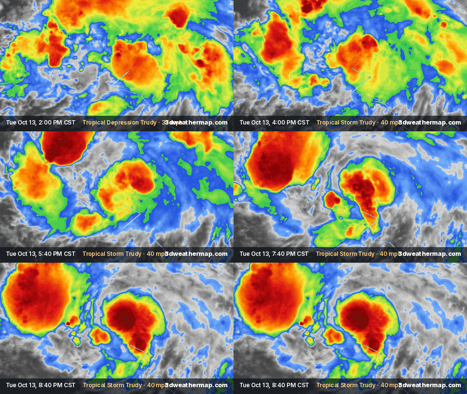
NHC: TRUDY FORECAST TO RAPIDLY INTENSIFY AND BECOME A HURRICANE TOMORROW · RESIDENTS OF SOUTHWESTERN AND WEST-CENTRAL MEXICO SHOULD MONITOR THE PROGRESS OF THIS SYSTEM
Summary
The National Hurricane Center (NHC) began advisories on Tropical Depression Twenty-One-E at 9:00 AM CST Tue, Oct 13, 2026, when it was 540 mi SSE of Acapulco Mexico, with maximum sustained winds of 35 mph.
It strengthened into Tropical Storm Trudy at 3:00 PM CST Tue, Oct 13.
Its highest maximum sustained winds in NHC products so far were 45 mph (70 km/h), at 9:00 PM CST Tue, Oct 13; the lowest central pressure reported so far was 1004 mb (29.65 inches), at 9:00 PM CST Tue, Oct 13.
As of NHC advisory 3 (9:00 PM CST Tue, Oct 13), Trudy is a tropical storm located 440 mi SSE of Acapulco Mexico, with maximum sustained winds of 45 mph and a minimum central pressure of 1004 mb, moving NW at 10 mph.
From NHC public advisories and updates; this page refreshes with every new one. Operational values — NHC's final best-track report may revise them.
Track
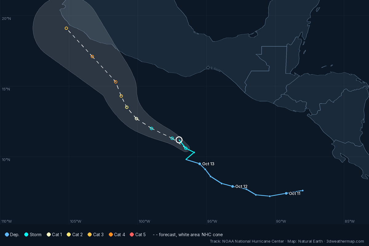
NHC advisory timeline
| Issued (CST) | NHC | Status · headline | Winds | Pressure | Position · motion |
|---|---|---|---|---|---|
| 9:00 PM CST Tue, Oct 13 | Adv. 3 | Tropical StormTRUDY FORECAST TO RAPIDLY INTENSIFY AND BECOME A HURRICANE TOMORROWRESIDENTS OF SOUTHWESTERN AND WEST-CENTRAL MEXICO SHOULD MONITOR THE PROGRESS OF THIS SYSTEM | 45 mph | ||
| 3:00 PM CST Tue, Oct 13 | Adv. 2 | Tropical StormTRUDY FORECAST TO RAPIDLY INTENSIFY TO A MAJOR HURRICANE OVER THE NEXT FEW DAYSRESIDENTS OF SOUTHWESTERN AND WEST-CENTRAL MEXICO SHOULD MONITOR TRUDY'S PROGRESS | 40 mph | ||
| 9:00 AM CST Tue, Oct 13 | Adv. 1 | Tropical DepressionTROPICAL DEPRESSION TWENTY-ONE-E FORMS OFF THE COAST OF SOUTHERN MEXICOFORECAST TO RAPIDLY INTENSIFY TO A MAJOR HURRICANE OVER THE NEXT FEW DAYS | 35 mph |
About this page
Built automatically from National Hurricane Center products (public advisories, intermediate advisories and tropical cyclone updates, linked above), NOAA GOES satellite imagery and NOAA MRMS radar. Times are CST (UTC-6), as in NHC's products.